
King Valley, Milawa & Glenrowan
King Valley
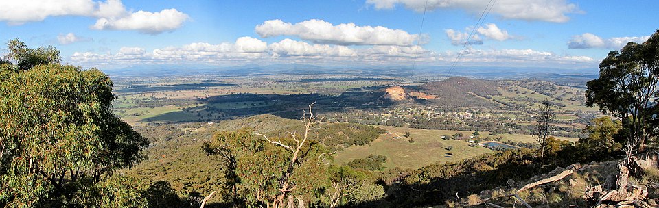
The King Valley, alternatively known as the King River Valley, is an agricultural and wine-producing region situated around the King River, spanning from Wangaratta to the Alpine National Park in the North East Victoria area of the Australian state of Victoria. Within this region, you can find several small towns, including Cheshunt, Whitfield, King Valley, Edi, Claremont, Moyhu, Byrne, Docker, and Oxley. The name “King Valley” received protection as an Australian Geographical Indication on October 12, 2007.
For over a century, the fertile valley has been utilized for diverse agricultural purposes. This has encompassed the cultivation of various crops such as hops and tobacco, in addition to dairy and beef cattle production. In 1889, a narrow-gauge railway was constructed between Wangaratta and Whitfield, while a government tobacco research farm was established in Edi, later moving to Whitfield in 1902. After World War II, a significant influx of Italian, Yugoslav, and Spanish migrants settled in the area, where they initially established tobacco farms. Following the eventual decline and demise of the tobacco industry in the mid-1980s due to government deregulation in 2006, local farmers diversified into other crops, including chestnuts, hops, berries, and the establishment of numerous vineyards.
The King Valley earned recognition as a wine region specialising in varieties such as sangiovese, nebbiolo, and barbera, among others. Notably, the region hosts some of Australia’s highest altitude vineyards, with some located around 800 metres (2,600 feet) on the Whitlands Plateau.
Milawa
Milawa is a charming town situated in Victoria, and it can be found along Snow Road, approximately 18 kilometres (11 miles) to the southeast of Wangaratta, within the Rural City of Wangaratta. As of the 2021 census, Milawa had a population of 588.
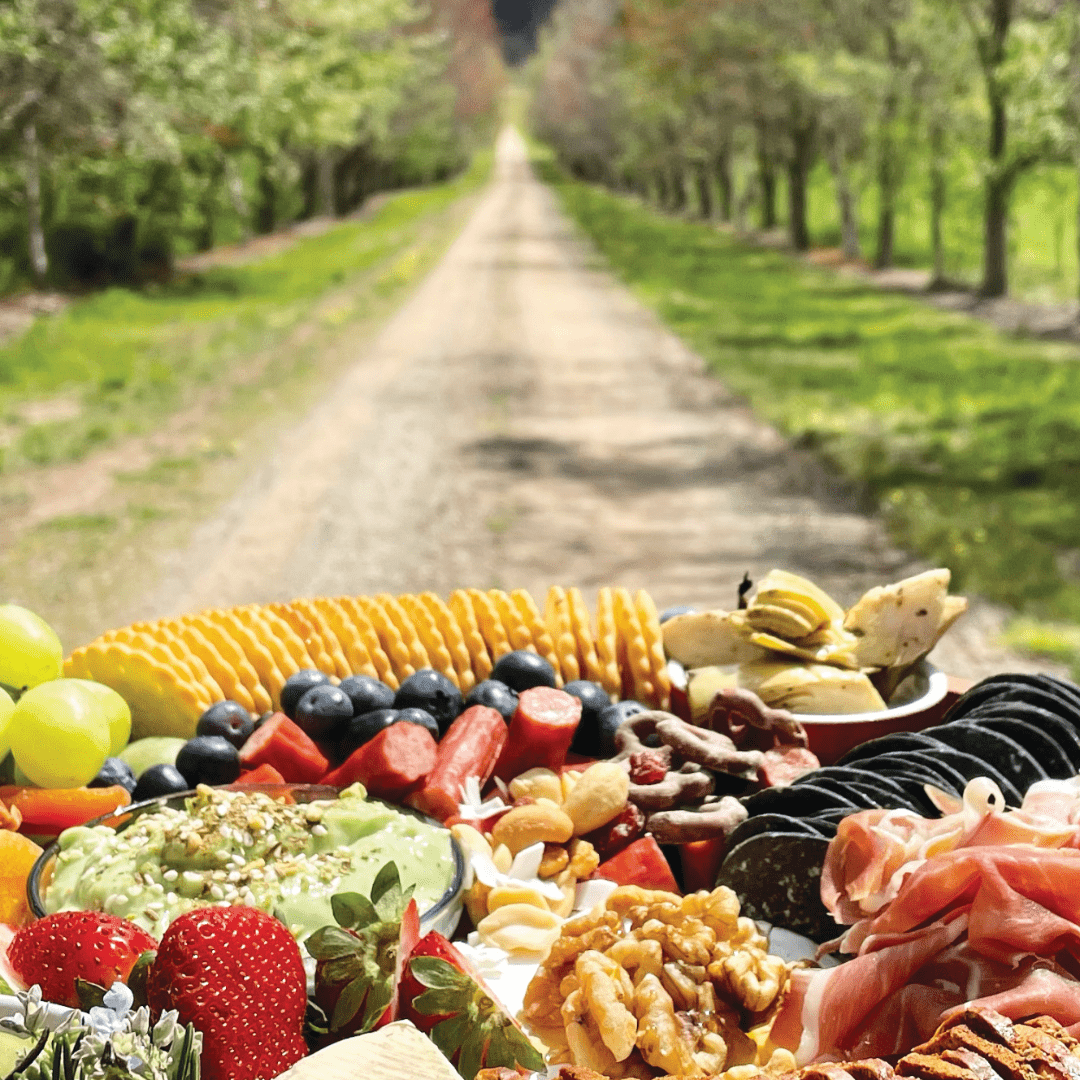
This town is nestled at the northern end of the King Valley wine region, situated between the King River to the west and the Ovens River to the north, where they converge in Wangaratta. Milawa serves as the central hub for the Milawa Gourmet Region, known for its diverse offerings of high-quality produce.
The name “Milawa” was adopted in 1873, following years during which the town was known simply as “The Square.” The word “Milawa” has Aboriginal origins, being a combination of “Mila,” signifying “Eyes,” and “Wah/Wa,” which denotes “water.” The Bpangerang people in the Milawa area were known as the “water watchers” who vigilantly observed the two main rivers, the King River (referred to as the Poodumbia) and the Ovens (known as the Torryong).
In the early days, the Emu Hotel occupied one corner (established by James Henley), while the Commercial was situated on the opposite corner (constructed by Colin Gardner). The town boasted general merchandise at McKenzie’s store, along with various craftsmen, including blacksmiths, a saddler, a bootmaker, a carpenter, and a doctor, Dr. McSweeney. The Post Office opened on July 7, 1862, initially as Oxley, and later as Oxley Plains until 1874.
Glenrowan
Glenrowan is a town situated within the Wangaratta local government area in Victoria. It is located 236 kilometres to the northeast of Melbourne, 14 kilometres from Wangaratta, and is in proximity to the Warby Ranges and Mount Glenrowan. As per the 2021 census, Glenrowan was home to a population of 1,049.
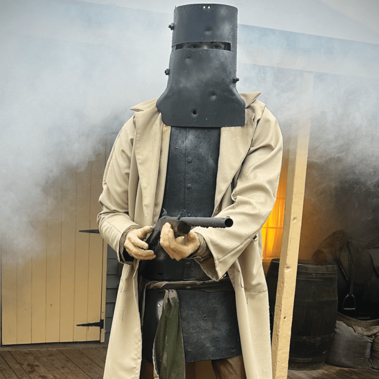
The town’s name, Glenrowan, derives from farmers James and George Rowan, who worked on farms in the area from 1846 to 1858. Glenrowan itself was established in the late 1860s, with the Post Office opening on February 22, 1870. The town is particularly renowned for its association with the infamous bushranger Ned Kelly, who made his last stand and was ultimately captured there in 1880 after a siege and a shootout with the police.
A local railway station was inaugurated in 1874 but ceased passenger services in 1981. Additionally, the town lends its name to the Glenrowan wine region, officially defined in 2003, with the first grapevines planted in 1866.